
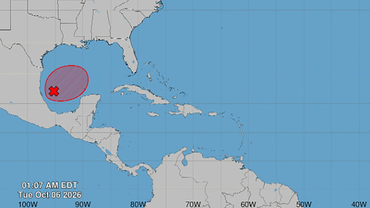
MIAMI.— The disturbance AL92 could become a tropical depression during the next few days over the Gulf of America, after the National Hurricane Center (NHC) raised its probability of development to 80%.
In the report issued at 2:00 am this Tuesday, the federal agency assigned the disturbance a possibility of formation of 80% for both the next 48 hours and the next seven days.
AL92 so far consists of a low pressure trough generating disorganized showers and thunderstorms over the southwestern Gulf.
Atmospheric conditions are only moderately favorable, but the NHC considers it likely that a tropical depression will form within a day or two.
Trajectory still uncertain
The phenomenon would move slowly towards the east-northeast during the first half of the week and then turn northward.
This general path directs attention toward the northern Gulf Coast, but there is still considerable uncertainty about the point of arrival, intensity and timing of any potential impact.
The NHC asked residents of that region to follow its evolution. However, at the time of writing, no coastal watches or advisories associated with AL92 had been issued. There is still no official career cone either.
If it reaches storm status and its sustained winds reach at least 39 miles per hour, it would receive the next available name on the Atlantic hurricane season list.
More rain in South Florida
For southern Florida, the National Weather Service in Miami warned that it is still too early to determine if the disturbance will have direct effects, since there is still no defined center or reliable trajectory.
Regardless of whether the trough becomes a tropical depression, the region will face increased rainfall due to the combination of abundant humidity from the Caribbean and a weak, almost stationary atmospheric boundary over the peninsula. These conditions may favor persistent downpours and localized flooding during the week.
Scattered showers and storms are expected this Tuesday, with greater activity during the afternoon over the metropolitan sectors of Miami-Dade, Broward and Palm Beach, as well as the Lake Okeechobee region. Some rainfall could be heavy, causing localized flooding in low-lying or poorly drained areas, especially where the ground remains saturated.
Humidity would increase more strongly starting Wednesday, when the border stagnates over the center of the peninsula. The final location of that atmospheric boundary and the evolution of AL92 will determine how long the rains will persist.
For now, forecasters are avoiding directly linking each South Florida downpour to the possible cyclone. Even if AL92 fails to develop, the tropical flow may maintain unstable conditions and episodes of heavy rain for much of the week.
The authorities recommend following official updates and not using maps or trajectories disseminated on social networks that do not yet come from the NHC.
