
MIAMI.– Tropical Storm Bertha brought an extensive area of rain and thunderstorms towards the Texas coast this Thursday, where the main threat will be the possibility of flash flooding, especially in urban areas and sectors with poor drainage.
Although Bertha maintains maximum sustained winds of 45 mph, its structure has deteriorated and most of the precipitation is separated from the center. Radar and satellite images show that the heaviest downpours are concentrated south of the storm and approaching the Texas coast.
In Advisory #17, issued at 11:00 am Miami, the National Hurricane Center (NHC) located Bertha about 35 miles south of Lake Charles, Louisiana, and 100 miles east-northeast of Galveston, Texas.
The formation was moving west at 10 mph, with a minimum central pressure of 1,004 millibars. Its tropical storm-force winds extended up to 160 miles from the center, although the strongest remained mainly over the sea and in the southern half of the circulation.
Flood risk in Texas
Bertha could leave general accumulations of between 2 and 4 inches of rain, with isolated maximums near 6 inches, on the Texas Gulf Coast and the south of the state through Thursday night.
This precipitation could cause isolated flash flooding. The danger will be greater in low streets, underpasses and urbanized areas where water can accumulate in a short time, according to NHC experts.
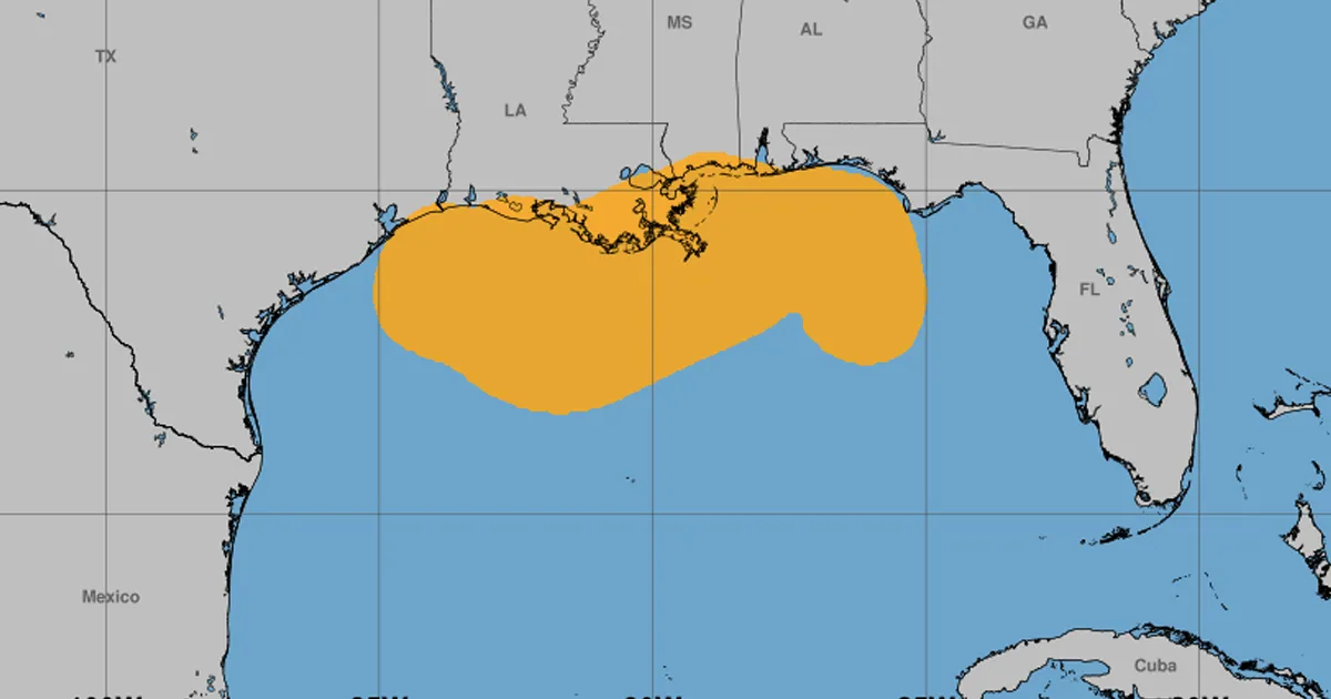
A tropical storm warning remains in effect from Morgan City, Louisiana, to Sargent, Texas. The warning was lifted for areas east of Morgan City, a sign that Bertha’s effects are moving further west.
The combination of surge and tide could raise water between one and two feet from Port Fourchon, Louisiana, to Port Bolivar, Texas. The storm surge will also maintain dangerous rip currents in the northern and northwestern parts of the Gulf.
A storm near its end
The center of Bertha will move near or along the coasts of Louisiana and Texas before entering Texas territory during the afternoon or evening of this Thursday.
The NHC does not anticipate major changes in its intensity before landfall. Strong winds in the upper layers of the atmosphere and the elongated structure of the storm would prevent significant strengthening.
Once in Texas, Bertha will quickly lose her tropical characteristics. The forecast indicates that it could become a weak remnant low during early Friday morning or dissipate completely in about 24 hours.
Bertha had already made landfall on Wednesday in southeastern Louisiana and then moved again over Gulf waters. Its arrival in Texas would mark the final stage of a storm that, despite its limited intensity, can still cause flooding and dangerous conditions far from its center.
