
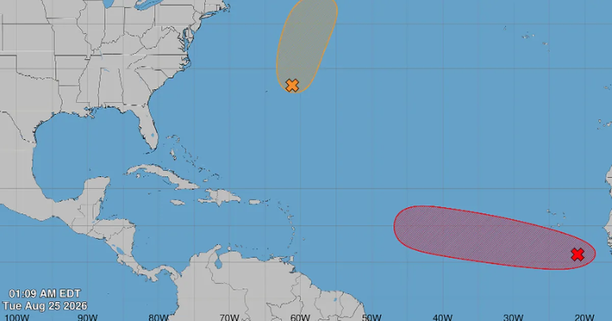
MIAMI.- The tropical wave that emerged from Africa continues to organize over the eastern Atlantic and now has a 70% chance of becoming a tropical cyclone over the next seven days, according to the most recent update from the National Hurricane Center (NHC).
The disturbance received the designation AL96used by meteorologists to perform more detailed analysis and run trajectory and intensity models. At 2:00 am on Tuesday the 25th, its low pressure center was several hundred miles south-southeast of the Cape Verde Islands.
The NHC increased the chance of development to 60% during the next 48 hours and to 70% within the seven-day period. A day earlier, the probabilities were 30% and 60%, respectively.
This increase means that atmospheric conditions have become more favorable and that a tropical depression is likely to form over the next few days. It does not indicate, however, that there is a 70% risk for Florida, the Caribbean or any specific territory.
A journey yet to be defined
AL96 maintains an extensive area of downpours and storms that is still disorganized. The disturbance moves towards the west or west-northwest through the eastern Atlantic and should subsequently enter the waters of the central tropical Atlantic.
Its great distance from the American continent makes it impossible to determine at this stage whether it will approach the Caribbean, turn towards open waters or lose organization before completing the journey.
Some preliminary models suggest it could gradually drift northward and remain over the ocean. This scenario is not an official forecast because the disturbance still lacks a well-defined center of circulation. The initial location of that center can considerably modify subsequent projections.
The NHC also anticipates that conditions could become less favorable over the weekend. The presence of dry air, dust from the Sahara and increased winds in the upper layers of the atmosphere could limit its strengthening.
Meteorologist Javier Serrano explained on his Instagram account that the tropical wave would have favorable conditions to become a cyclone in the coming days. He added that projections begin to suggest a gradual turn toward the northwest before the disturbance reaches the Antillean arc.
However, he agreed that it is too early to establish a definitive route or determine possible effects on the Caribbean and Florida, so it will be necessary to observe its organization and future updates.
Another disturbance near Bermuda
The NHC also observes low pressure AL95, located about 200 miles east-northeast of Bermuda. It has a 40% chance of development and could briefly become a depression or tropical storm this Tuesday.
However, its circulation remains wide and elongated. In addition, it moves north, where it will find colder waters and unfavorable conditions between tonight and Wednesday. It does not pose a threat to Florida, according to experts.
The evolution of AL96 requires monitoring over the next few days as it coincides with the most climatologically active stage of the season. For Florida residents, the outlook does not call for extraordinary measures, although August and September are suitable months to review supplies and family plans.
